
+30%
Operational Efficiency
24-hour continuous operation, optimal path planning and centimeter-level precision control, maximizing land utilization with 30%+ overall efficiency gain.
Through the closed loop of precision sensing, smart decisions, and autonomous control, we achieve unmanned, precise, and efficient agricultural production, creating outstanding economic and social value for customers.
24-hour continuous operation, optimal path planning and centimeter-level precision control, maximizing land utilization with 30%+ overall efficiency gain.
Precision control reduces seed, fertilizer, and pesticide waste by 15–20%; unmanned operation cuts labor and management costs, reducing overall operating costs by 20%+.
Multi-source sensors and cloud analytics support field information collection, variable-rate operation, and agronomic decisions-a key enabler of prescription farming.
Multiple safety redundancy with multi-sensor fusion for all-weather, all-scenario obstacle recognition and avoidance, effectively preventing operational accidents.
Integrating four core capabilities-vehicle low-level control, intelligent path planning, environment perception and obstacle avoidance, and cloud remote management-covering the full chain from single-vehicle operation to fleet dispatch.
Start and stop the machine remotely via cloud platform or mobile app.
Controls forward/reverse and throttle opening for consistent operation quality.
Achieves ±2cm path-tracking accuracy, maximizing land utilization.
Dual safety takeover via physical button and software interface.
Auto raise/lower implements and start/stop PTO at headlands, fully automating workflows.
Supports A-B point, curve, and loop modes with auto-generated optimal paths.
After completing a task, autonomously travels along farm roads to the next plot.
Fuses mmWave radar, cameras, and LiDAR for all-weather active safety.
Uses SLAM to supplement positioning in weak or lost GPS areas, ensuring continuity.
Vehicle status monitoring, trajectory replay, geofencing, and statistical reports.
Plot delineation, task dispatch, parameter adjustment-one person managing multiple machines.
Provides MQTT and API standard interfaces for third-party platform data integration.
Cross-applying 3D BEV and 4D temporal occupancy networks from autonomous driving to agriculture, achieving efficient multi-scenario adaptation with a minimalist hardware architecture.
Just 6 automotive-grade HD cameras reconstruct the full 360° 3D space around the vehicle. Using the chassis center as origin, 2D pixel features are implicitly transformed into 3D BEV features, fused across space and time on a unified bird's-eye-view sandbox. Even in featureless open fields, it locks onto surface features in milliseconds.
For extreme unstructured conditions—high dust, violent vibration, muddy occlusion—a spatiotemporal correlation model with temporal memory filters transient noise and recognizes all-terrain micro-geomorphology.
100–200 TOPS dense compute, end-to-end latency ≤80ms. Full aluminum fin passive cooling, fanless sealed design, IP69K protection—impervious to mud, dust, and high-pressure washing.
The standardized bus-bridge gateway acts as a protocol translator, directly connecting to the vehicle's drive-by-wire system via CAN, penetrating the throttle, steering, hydraulic, and powertrain ECUs. Fully compatible with ISOBUS (ISO 11783), enabling seamless cross-brand coordination. ≤80ms link latency eliminates trajectory divergence and wandering at 15 km/h.
Boundary-free global path generation + high-precision RTK and vision fusion positioning, enabling predictive obstacle avoidance, dynamic safety corridor recalculation, automatic fault tolerance, and remote expert diagnostic OTA.
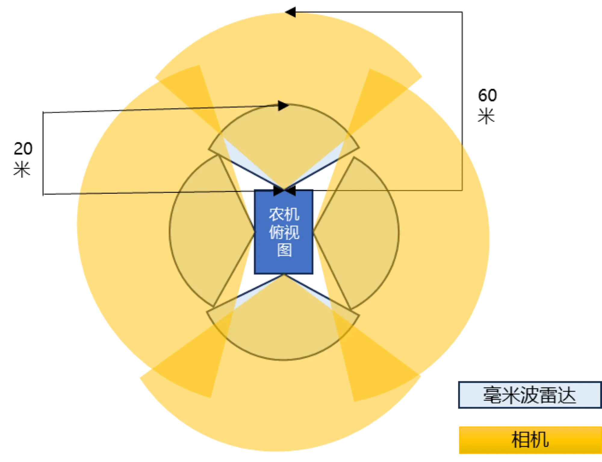
6 surround cameras + mmWave radar + RTK fusion positioning build a 360° zero-blind-spot perception field. Forward long-range detection, surround near-field fill, and RTK centimeter absolute positioning-three guarantees for ±2cm accuracy and all-condition safety redundancy.
For extreme unstructured conditions-high dust, violent vibration, muddy occlusion-a spatiotemporal correlation model with temporal memory filters transient noise and recognizes all-terrain micro-geomorphology, reducing field false-stop rate by 90%.
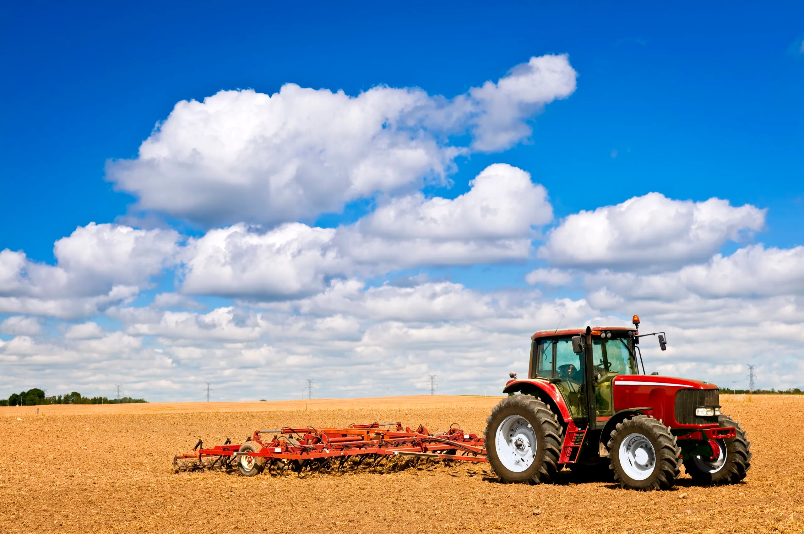
vs Traditional third-party - John Deere
| Dimension | Traditional | John Deere | AGINNO BEV |
|---|---|---|---|
| Full-chain latency | 500–1200ms | ~100ms | ≤80ms Hard real-time deterministic latency |
| Sensor footprint | 4–8 cameras + external LiDAR | 16 cameras + dedicated Ethernet | 6 HD cameras Vehicle cost −60% |
| Max operating speed | ≤5 km/h | 12 km/h | 15 km/h Daily acreage +25% |
| Vibration & dust resistance | Poor (false-stop prone) | Moderate (geometry drift) | Excellent (4D temporal memory) False-stop rate −90% |
| Micro-terrain detection | Cannot detect depressions | 15cm vertical targets | 10cm pits/sinkholes Protecting heavy assets |
| Implement integration (ISOBUS) | Navigation only, blind implements | Deep but locked ecosystem | Full ISOBUS compatibility Seamless cross-brand bridging |
| Multi-machine overlap | 10–20cm missed strips | Machine Sync system | Dynamic RTK + vision fusion ≤2.5cm Zero grain spillage at unloading |
From cloud task orchestration to onboard autonomous execution, from predictive safety to automatic fault tolerance-AGINNO builds a complete L4 full-autonomy stack.
Cloud task orchestration and dispatch, smart terminal real-time control, onboard unmanned monitoring, digital twin global command dashboard.
Boundary-free global path generation, high-precision RTK and vision fusion positioning, centimeter-level path planning and full-auto steering.
Multi-modal obstacle prediction and active bypass, dynamic safety corridor recalculation, zero-blind-spot 360° situational awareness.
Fault self-diagnosis and auto-recovery, tiered fuse and safety stop, expert remote diagnostics and software OTA.
Onboard embedded system, cloud management platform, mobile app, and open data interface-four layers working together for stability, reliability, and scalability.
Based on Linux and ROS, high real-time performance and reliability, with perception fusion, decision planning, and motion control core algorithm modules.
SaaS architecture, multi-user multi-permission. Fleet management, task dispatch, data visualization, operation report analysis, remote diagnostics, and OTA upgrades.
Android / iOS support. Plot management, path planning, task start/stop, device monitoring, parameter settings-intuitive and easy to use.
Supports MQTT protocol for standard agricultural IoT data, provides RESTful API for third-party system integration, breaking data silos.
Unified multi-vehicle management, real-time status monitoring
One-operator-multi-machine grid dispatch, cross-plot coordination
Operation boundary enforcement, no crop damage
Historical operation path replay and reports
Expert remote access, rapid fault localization
Operation report analysis, data-driven decisions
Composed of high-performance hardware kits and a powerful software platform, ensuring stable, reliable, and efficient system operation. Every component is automotive-grade validated.
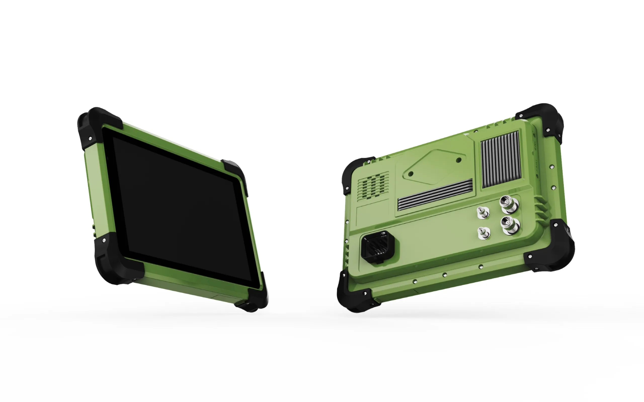
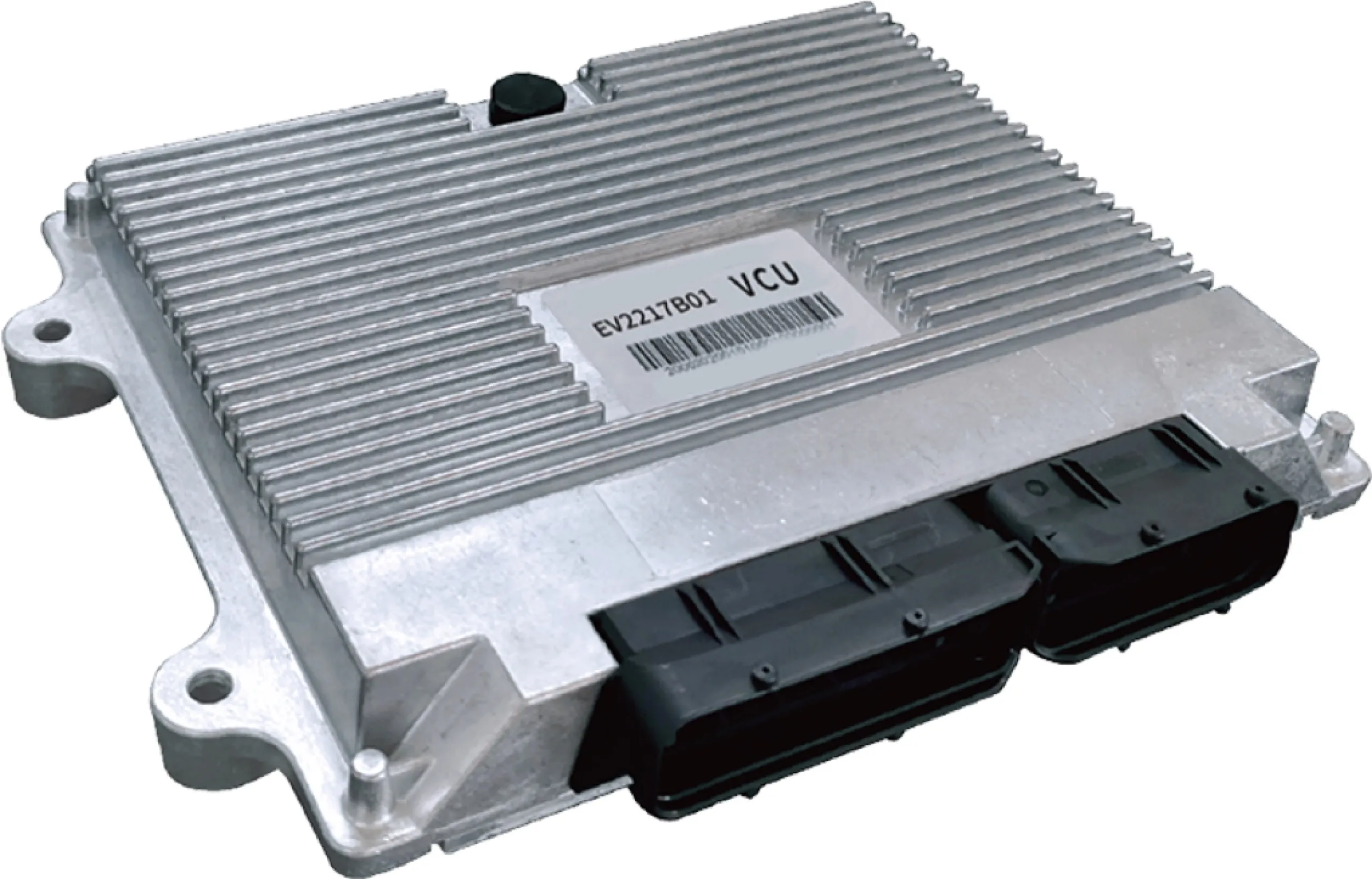
From positioning and navigation to environmental adaptation, every metric is field-validated for all-weather, all-scenario stable output.
Traditional solutions rely on multi-camera 2D pixel stitching and rigid geometric ranging, mounting 16 external cameras; AGINNO uses a BEV pure-vision architecture, achieving full 360° 3D reconstruction with just 6 cameras.